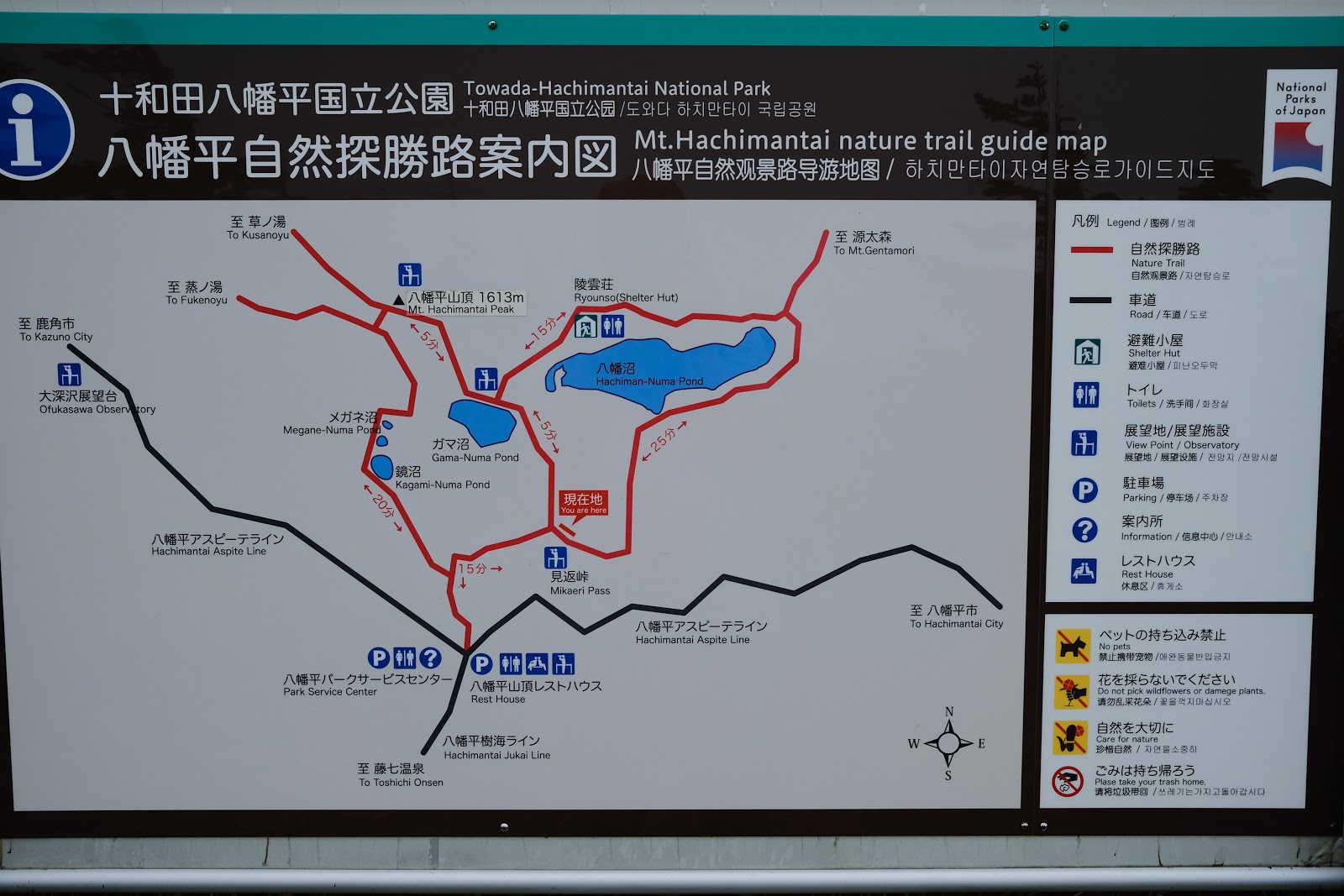
This map pretty much explains it all. We started where the "P" mark is near the bottom of the map. We walked the circumference of the red trail. We ate a box lunch at the halfway point; and we finished where we started.
The lady with the pink backpack was our volunteer guide.

The trail starts right on the border between Akita and Iwate prefecture.

Of course all hikes have to be an uphill battle.

Follow the guide! She's the only one that knows where we're going.

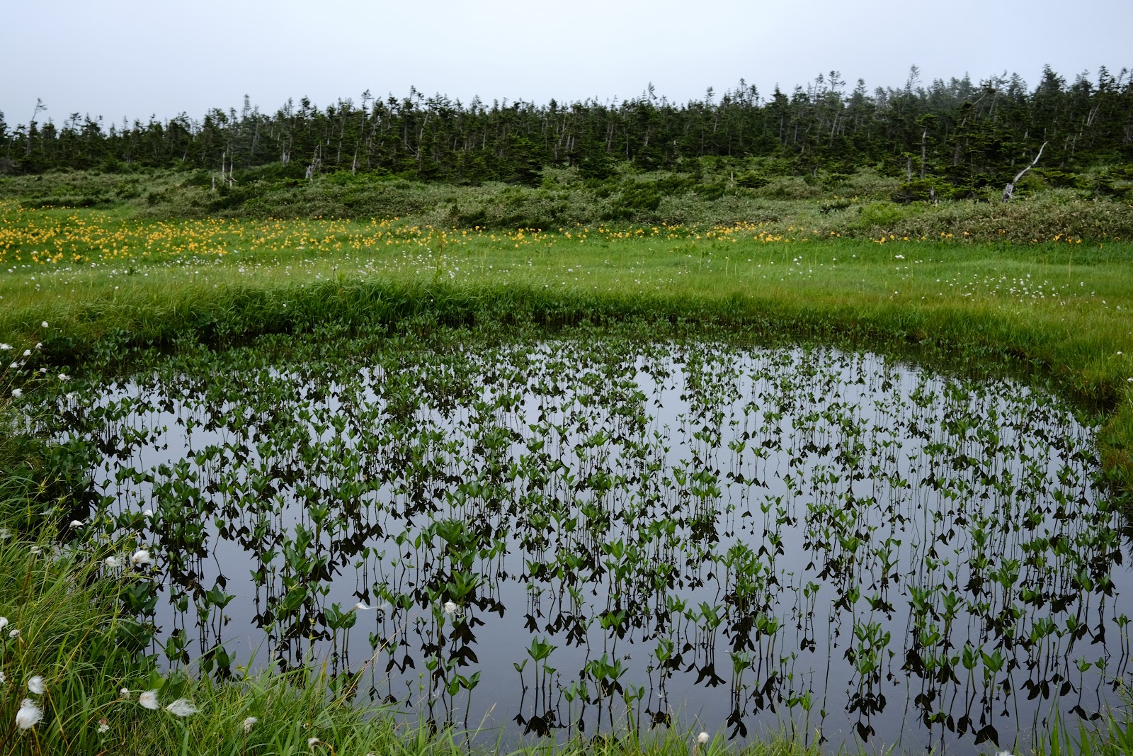
The first of the small lakes we'll be walking by.


We have reached the summit.

Even though we are on top of a mountain it doesn't feel like it.

Another lake.

And, another lake.

This is the biggest of them.


The guide points out some kind of mountain flower to Emi.

Very scenic, it's a good place to eat lunch.

The view from our picnic site.

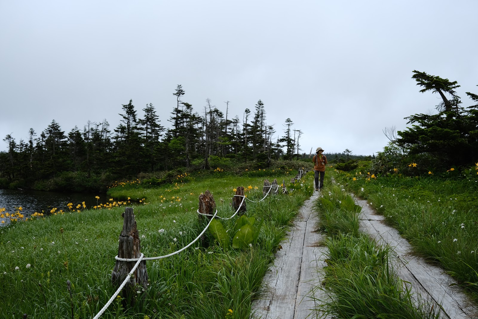
On the road again, only this time the road is made of wood. The top of the mountain is a marsh and the trail is elevated planks over the watery marsh.


It's very nice here.


A stranger heading in the opposite direction passes by us.


It is so nice and peaceful out here that I have completely forgotten about the global pandemic.


This is where the marsh ends...

...and we return to firm land. I feel kind of sad because this means our walk is nearly over.

We stopped for a moment to look at a map the shows us where we've been and then we descended down the trail to the parking area.

Thanks for stopping by!
Mike
Bonus shots!
Images taken on my morning walk around Yokosuka.


No comments:
Post a Comment